
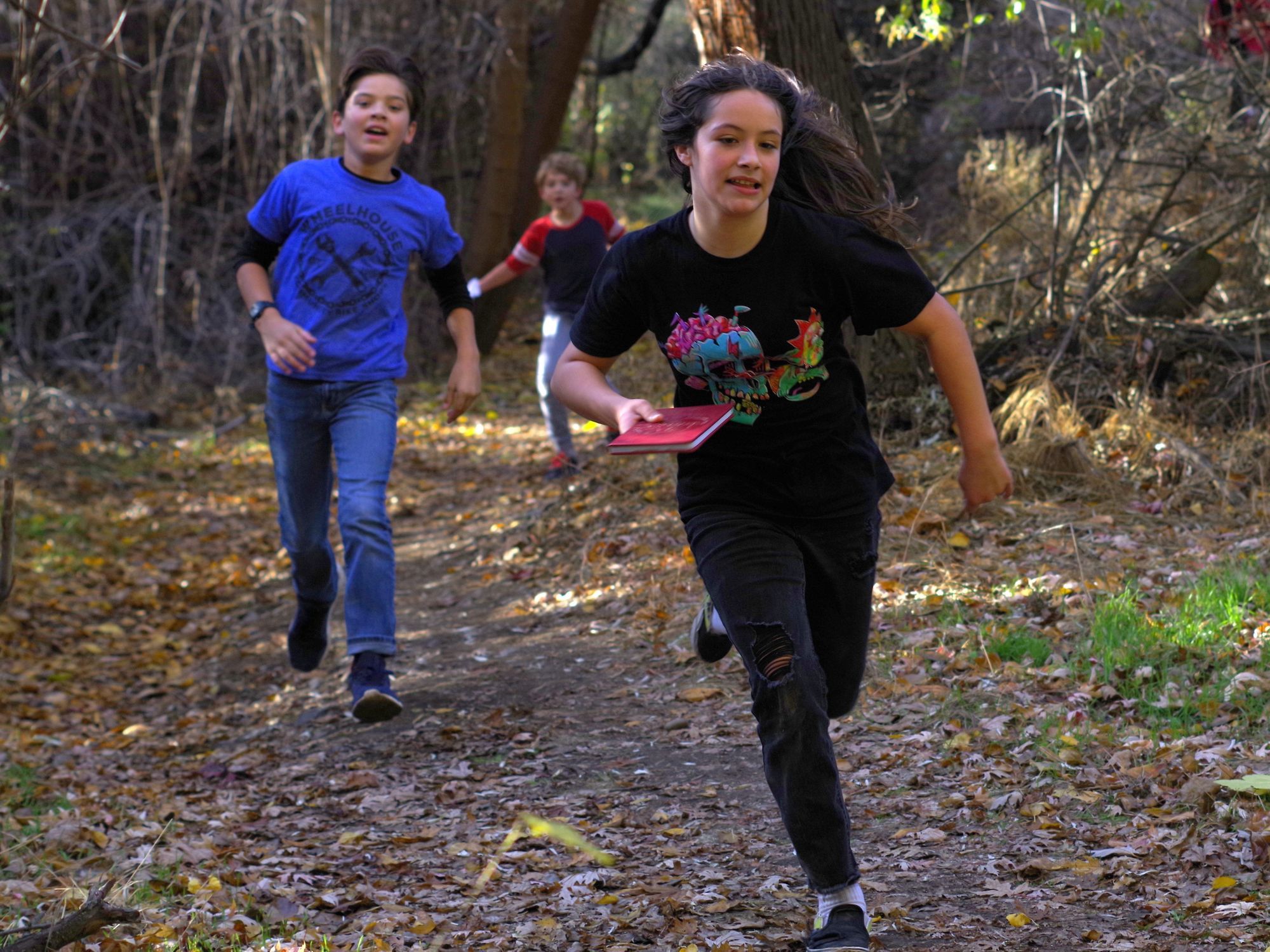
If you’ve ever looked at our Trips for Kids photo album on Facebook, then you’ll know that Chamna Natural Preserve is one of the best places to bike in the Tri-Cities. Still, it can be a little intimidating to venture into the tall Wyoming sagebrush on two wheels if you’ve never been before. The trails are best for biking between October and May. Here’s a guide to help you get out to Chamna on two wheels, either on your own or with your family.
No fancy bikes required
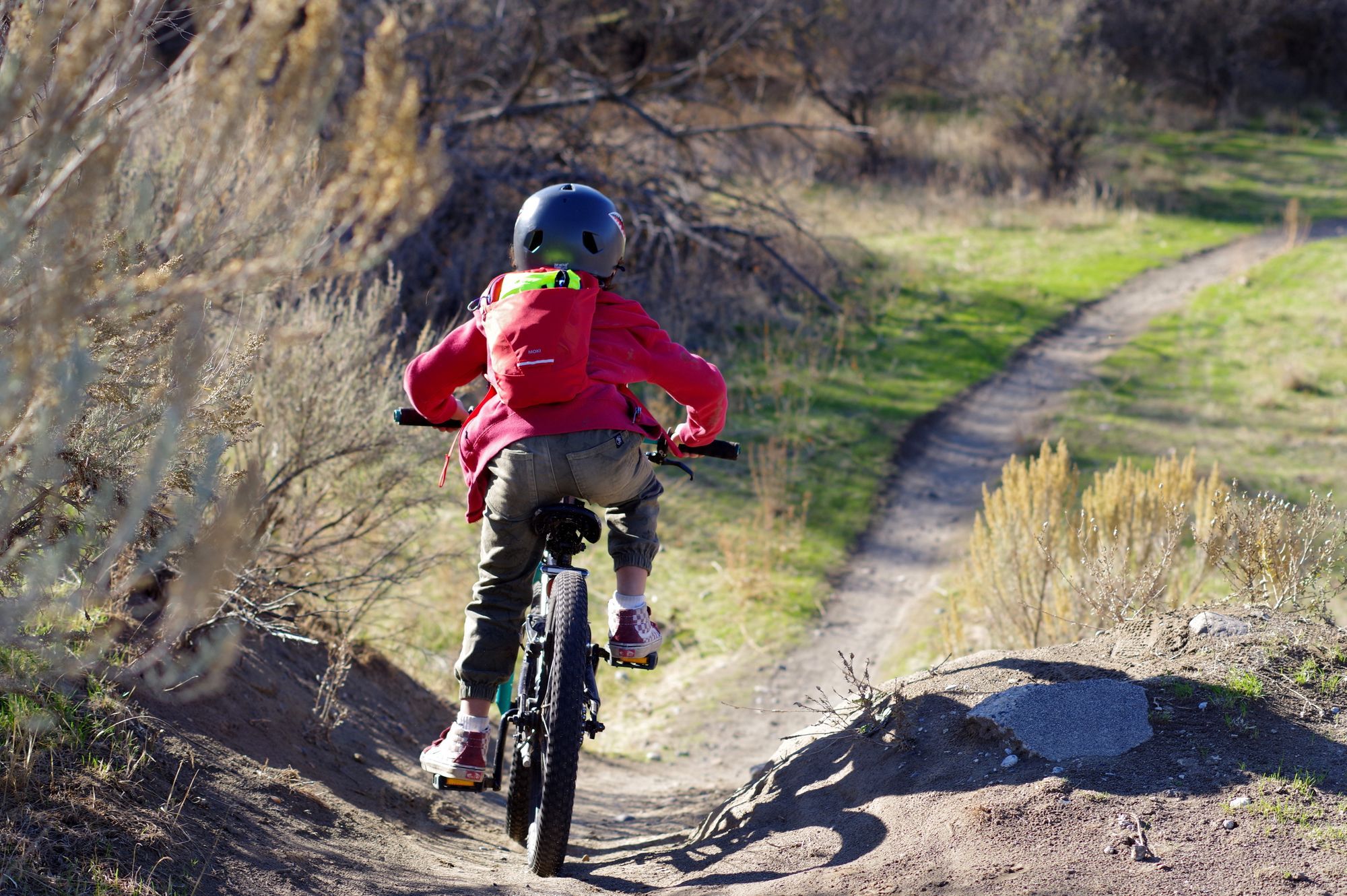
Most of the trails at Chamna would be described as ‘singletrack’ but you could navigate them on just about any bike. There are even a few wide boulevards that you could easily navigate on a tricycle! Most of the trails are wide, straight, and flat. You can get around any of the trails comfortably on a single speed cruiser with a coaster brake. It might chatter your teeth a little on a skinny, smooth-tired road bike, but if it’s not too dusty or too muddy, you’d still get around most trails just fine.
Trail etiquette
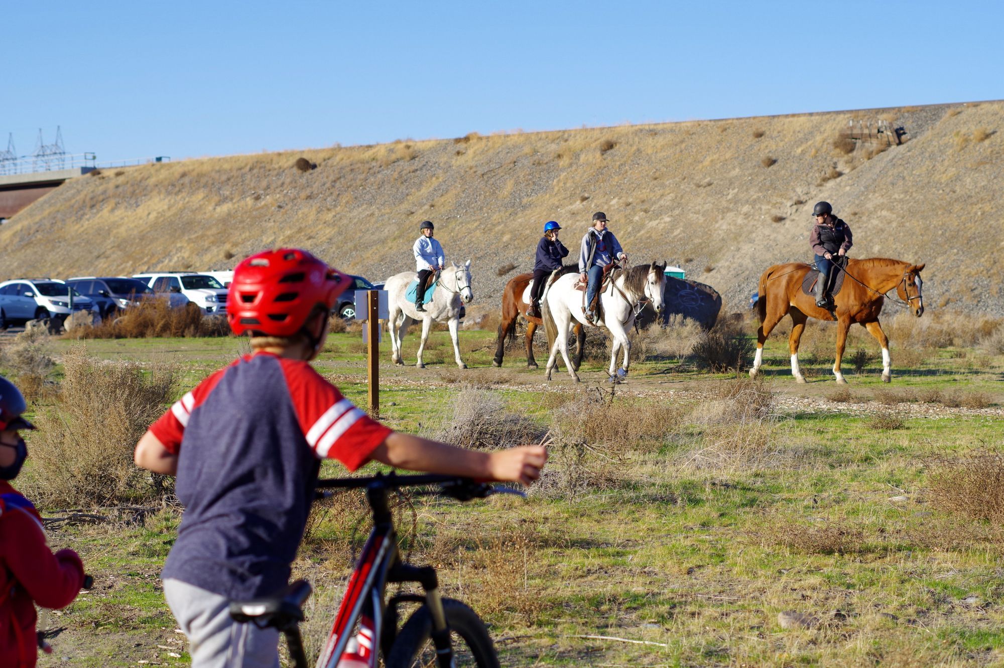
Chamna trails are used by walkers, trail runners, equestrians, and bikers. Bikers are required to yield to every other trail user. Often, walkers will step off the trail to let you pass, so please acknowledge them for yielding to you when it should’ve been the other way around. You’ll often be alerted to the presence of horses by the trailers in the parking lot — but not always. Chamna trails are connected to the Richland Riders Club, and sometimes riders hack into Chamna, so always be alert. If you see or hear a horse, stop, move your bike to the side of the trail, and don’t make any sudden movements or loud noises that could spook the horses. Always stay on the trail, don’t create new trails, and avoid skidding, especially in corners. There are a lot of tree forts and short trails down to the river to explore; make sure you don’t block the trail with your bikes.
Where to ride
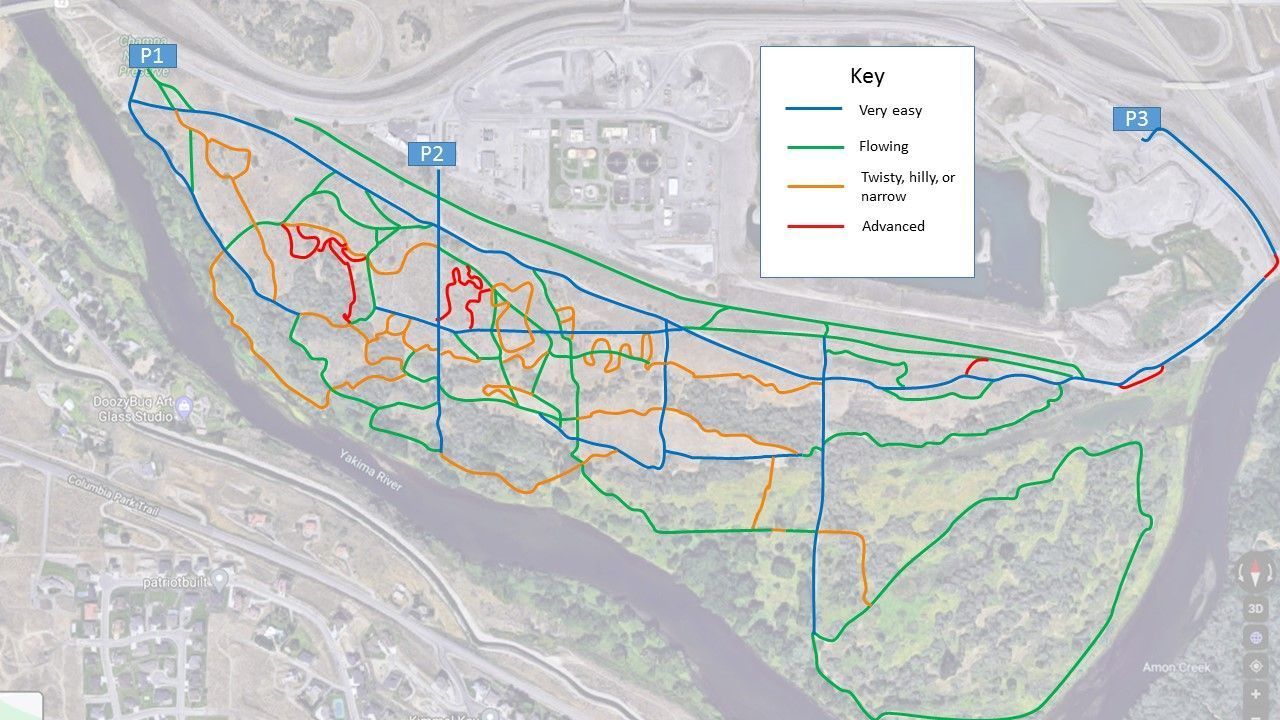
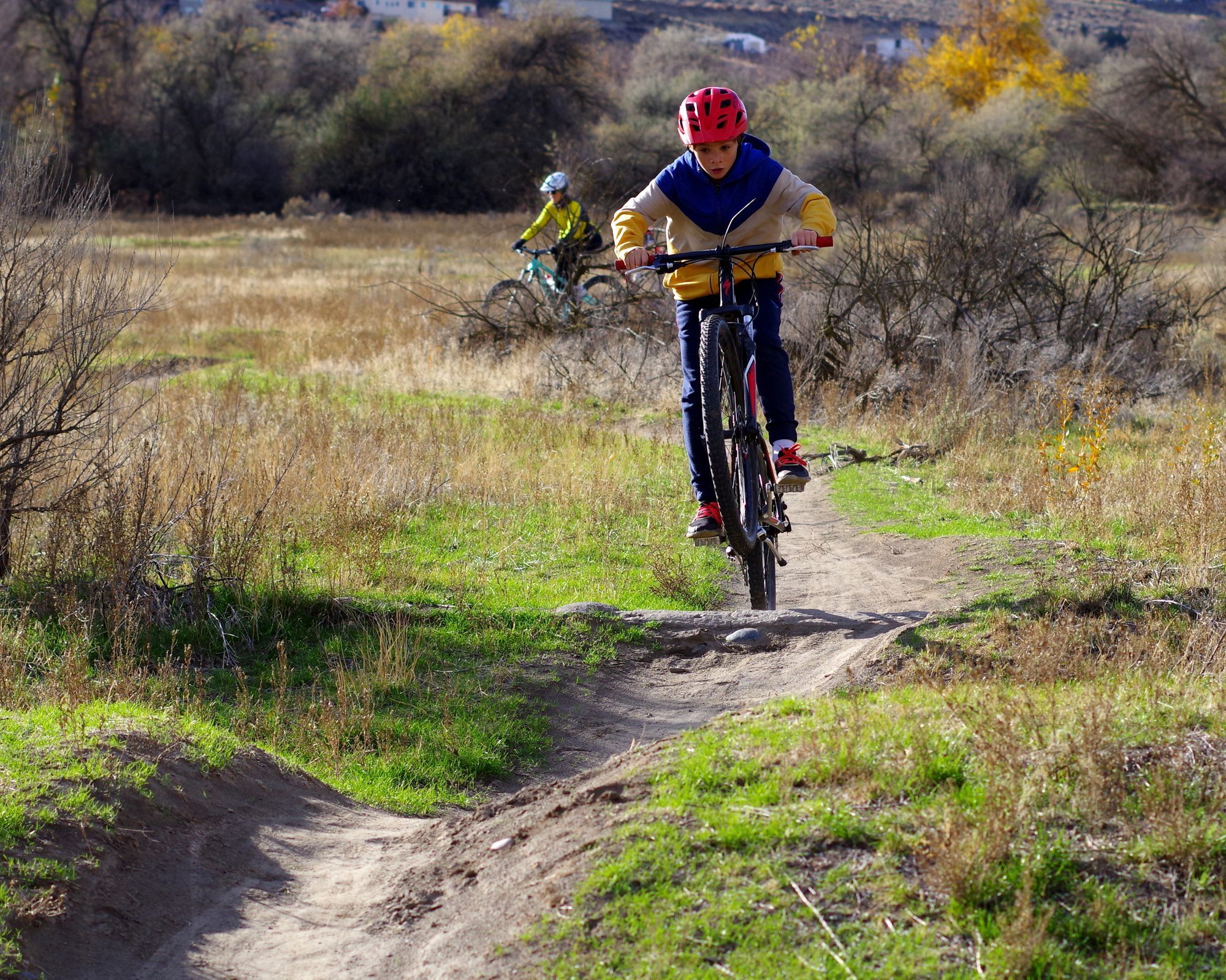
There are a lot of trails at Chamna and many of them are not on the official map. I made my own trail map and graded the trails by ease for biking. I categorized the trails into four different grades. Blue trails are wide and flat. Green trails are also wide and flat, but they may have sharp corners in the tree tunnels and occasional roots that could make you come unstuck if you don’t see them. If it’s your first time, aim for the blue and green trails; these are typically the ones you see on the maps posted around the preserve.
First timers who are feeling confident can venture onto the orange trails. These are narrower, twistier, or have some dips to zoom through. The trails marked in red are more technical. These are best suited to people with a little experience riding single track, or some basic instructions in the foundations. I have taken children as young as five on all the trails on this map except for one short segment.
The peninsula loop and all the trails nearest the Yakima River can get a little slick when the water table is high or after a big precipitation event. In the summer, these trails hold their traction the longest and the upland trails become dusty.
What if I get lost?
Chamna is well covered with cellular signal, so you can always pull up Google maps and navigate out that way. There are a few strategies for wayfinding through the park without technology. Badger Mountain and the rail embankment are two prominent landmarks to guide you back to the exit. Don’t put too much store in the Yakima River to help you on the Peninsula because it’s on three sides of you. If you lose your bearings, go north; the vegetation thins and there’s a ridge that gives you a good vantage.
Amenities
There are no faucets or water fountains, so take your own water. There is one portaloo in the main parking lot (labeled P1 on the map). There is only one bike rack, also near the main parking lot. There are a few trash cans in the main parking lot, but none throughout the park. When I ride with kids, I bring a patch kit, multitool, and first aid kit. So far, I’ve only had to use the multitool.
What about eBikes?
eBikes are increasingly being recognized as assistive mobility devices. Many people with mobility disabilities cannot walk far but can ride a bike comfortably — particularly an eBike. The rules about where you can and cannot ride eBikes are a bit of a patchwork. According to the parcel map, the property is owned by ‘GOVERNMENT’, which I assume means the Federal government. The Department of Fish and Wildlife and many other Federal land management agencies now allow eBikes anywhere that bikes are allowed. This vastly expands opportunities for people with mobility deficits and disabilities to enjoy equal access to natural areas. You can read more here: www.fws.gov/refuges/biking/e-bikes.html
What is an eBike? There are three classes of eBikes that are legally defined as bicycles under State and Federal law. These eBikes may or may not have a throttle and they are all speed limited to 20 mph or 28 mph for Class 3. The vast majority of eBikes sold in bike shops or direct to consumer are Class 1 or Class 2. Most people operate eBikes well below the maximum speed! Trail etiquette applies to everyone.
How to get there
One of my favorite aspects of riding at Chamna is that it is so accessible by bike! Chamna is connected to the Sacajawea Heritage Trail on the east side. There’s a junction in the trail that goes under the Yakima River bridge and over the rail line at the eastern end of Carrier Road. The paved trail continues to Carrier Road, but there’s a dirt trail that leads straight into Chamna, affectionately known as the ‘back door’. It’s also easy to bike into Chamna the same way that you would drive — over the Jadwin Avenue bridge. At the intersection of Carrier Road and Lacy Road, there’s a little dirt spur — officially called Cullum Avenue — down to a parking area labeled ‘P2’. This access point is the fastest way to reach the best mountain biking trails. If you’re coming from south of the Yakima River, you can take the bike path over the interstate bridge. You can also come from the west via the bike path or via the Tapteal Greenway, which connects to WE Johnson Park.
Learn more about Wheelhouse Bike Community at wheelhouse.bike
Trips for Kids: https://wheelhouse.bike/trips-for-kids-mid-columbia
Photos by Francesca Maier